Four stunning hiking trails
Lift your gaze and enjoy. Every step brings you to new views, new impressions. Every hike is of course beautiful in its own way, but if you are looking for really impressive and scenic views while hiking in Åre, here are four favorites to begin with.
Totthummeln around & up
Climb: 515 m | Length: 3,3 km
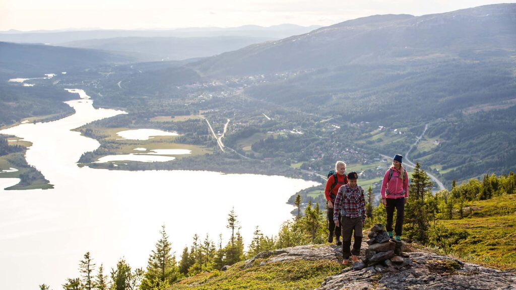
Totthummeln is the small hill on the east side of the village, just above Tott Hotell. The trail offers lush vegetation on the way up. An easy to reach summit with a stunning view both to the east and west. A frequent after work hike for locals.
Find it: Take trail 212 Trollstigen from Åre Square and rejoin trail 213 on level with Hotell Fjällgården. Hold your left when the trail enters the forest at the foot of the small hill.
Lillådammen
Climb: 290 m | Length: 7 km out and return
The first reward is reached right after you’ve passed the tarn Byxtjärn and the small birch forest. Suddenly the landscape opens up in front of you and Mt Åreskutan appears in all its glory. To the right lake Kallsjön with surrounding villages an the mountain range Skäckerfjällen. Take a pause at the shore of the small lake Lillådammen before you head back.
Find it: Start at Fröå Gruva and follow trail 221.
Copperhill – Björnen
Drop: 180 m | Length: 2,1 km one way
This is usually a trail recommended to take from Björnen and climb to Copperhill Mountain Lodge in order to set the hotel and its amazing view as a goal for the hike. But our tip is to reverse the hike (or take it both ways). The most beautiful part is after the first climb from the hotel, at the height just north of it. The trail moves through lush greenery with Mt Åreskutan in sight.
Find it: Take the trail just north of Copperhill Mountain Lodge. Follow trail 222 to Björnen.
The summit of Mt Åreskutan
Climb: 146 m (or 1000 m) | Length: 2 km (or 5 km) one way
The easiest way to reach the top of Mt Åreskutan is to hike from the mountain station of the cable car. The toughest way ist to follow the Vertical K-trail. There are also two less tough (but longer) trails to choose, one at 8,1 km (trail 214) or 9,1 km (trail 215 – the East trail). Make sure to take a coffee and a waffle at Toppstugan – Sweden’s highest situated café.
Find it: Follow trail 214b from the cable car and gondola top stations.
PS #1 Keep in mind that the weather can change quickly so make sure to bring clothes to keep you warm and dry through a rain shower or cold winds. DS.
PS #2 There is no shame in turning back. The mountain will be there an other day for you. Better safe than sorry. DS.
Last updated 11 August 2023