
Ski Touring in Ullådalen
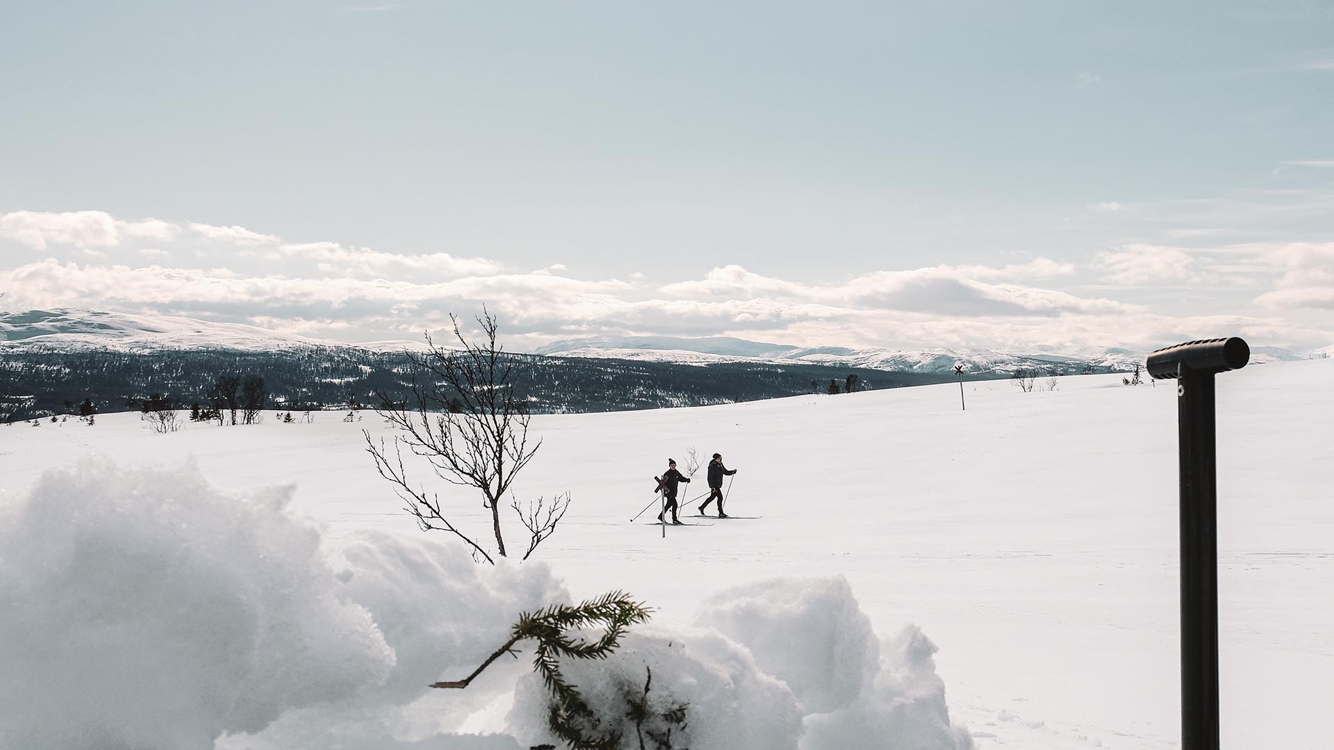
Spring feeling in Ullådalen.
Photo: Anette Andersson
Leaving the Åre village for a day in the mountain area Ullådalen is a bit like opening your lungs wide open and rebooting your mind at the same time. This widespread, snowy white and hilly landscape takes your breath away. Tour skiing in Ullådalen is a great way to explore this area, with mountain views in every direction. We have listed below three of our touring favorites in beautiful Ullådalen that work for different levels of adventure and skill. Choose the right trip for your enjoyment and endurance level.
Lillåstugan
Distance: 1.9 kilometers (one way)
The trail from the parking lot in Ullådalen to the traditional Lillåstugan waffle hut is quite an easy and short tour and with a great reward at the end. Waffles have been produced in Lillåstugan for generations and they also serve a variety of food, pastries and hot drinks. The trail varies a bit from slightly hilly to leveled so make sure you know both how to break and to ski uphill. Skins or other types of skis that don’t require wax is the best choice for children.
How to get there: From the E14 road, turn up towards Ullådalen and Rödkullen. Park at the parking lot in Ullådalen and follow the signs towards Lillåstugan. Aim towards Mullfjället and follow the trail over the stream Ullån, keep to your left and follow the signs to Lillåstugan.
Find the trail at aretrails.com
An alternative route: To make the trip to Lillåstugan longer, you can choose to take the extended route Till Lillåstugan långa turen, making this a round tour of about 6 kilometers in total. After you have passed the river Ullån, keep to your right and follow the 5 kilometer trail uphill and to the north. After the long uphill section keep to your left towards Mullfjället (the long mountain ridge opposite of Åreskutan) and then follow the signs to Lillåstugan.
Ullsjön & Stendalen
Distance: 2 kilometers (one way)
The trail starts from the start of the Ullådalen ski lift and can be reached from the parking lots in Ullådalen by following the ski slope next to the parking lots, upwards. On your left you will find a marked trail that goes through the forest and heads straight between Mt. Mullfjället and Mt. Åreskutan. The first part is a shared track with oncoming skiers so beware and keep to the side of the track when meeting others. After following this trail for a while, you can chose to turn right towards Stendalen or straight ahead towards the lake Ullsjön. This is a nice place for a pause and something to munch on before you turn and go back in the same tracks.
Find the trail at aretrails.com
Åreskutan Runt (Around Mt. Åreskutan)
Distance: 19.2 kilometers from A to B
This is a serious A-to-B day trip with varying and sometimes challenging conditions. The trail starts at Ullådalen and ends in Åre Björnen on the eastern side of Mt. Åreskutan, so you need to figure out the logistics of getting back home before heading out.
The beginning of the trail is the Ullsjön and Stendalen tour (see above). After passing Ullsjön you continue into the birch forest before reaching higher and out in open mountain terrain, thereby exposing yourself more to the current weather conditions, on the northern side of Mt. Åreskutan. The highest point of the trail is 900 meters above sea level and there’s a beautiful view of the Kall area and Lake Kallsjön from the backside of Åreskutan. The trail climbs upwards after about 12-13 kilometres and ends with a long descent to Björnen, which can be quite a challenge if you are tired.
Find the trail at aretrails.com
Note: This tour is tough and you are exposed to the elements so be prepared before heading out as the weather may change during the tour. Make sure to pack a map, compass, extra clothing and enough food and drinks.
Before you Go
+ Remember to inform someone where you are heading and when you plan to be back
+ Don’t go alone
+ Make sure to check the weather forecast before you head out – the mountain weather can change fast
+ Bring fluids and quick energy supplies
+ Pack extra clothing such as a warm jacket, beanie and warm mittens
+ Make sure you have a fully charged mobile. Mountain Rescue can be reached at the emergency phone number 112 if in need. NOTE – Mobile coverage can be limited in this area
+ Control and preserve your energy so that it lasts the whole way
+ Also, have fun!
+ More tips on how to prepare yourself and experienceing the mountains in a safe way is found at Fjällsäkerhetsrådet.se
More Skiing
Last updated 16 October 2025


