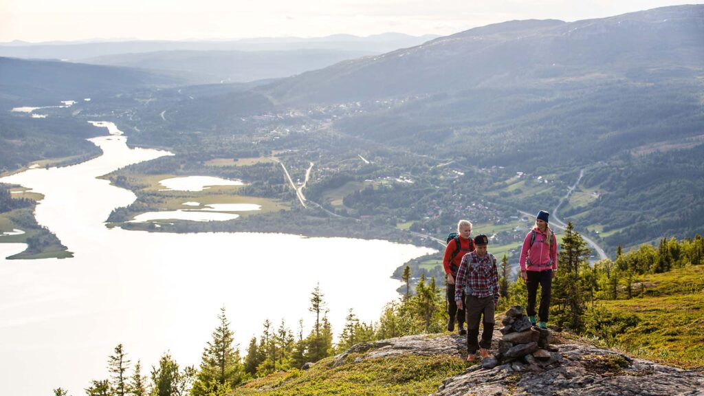
View from Mörvikshummeln
Photo: Anette Andersson
9 gorgeous hiking destinations in Åre
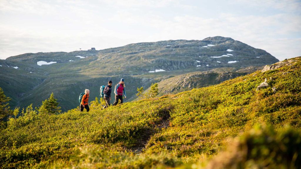
Åreskutan’s top, Fröå Gruva, Totthummeln and Nalleklippan are some of Åre’s most famous excursion destinations. But there is a whole series of slightly lesser-known places that are also given on the hikes. Here we suggest 9 gorgeous hiking destinations in Åre for you to enjoy.
Åre Trails is a digital map guide that helps you find your way – but if you prefer a paper map, it is available for free in all Skistar shops and in many hotel reception.
#1 Nalleklippan – viewpoint with a fantastic view of the village
This fantastic view point with an unbeatable view of Åre village and Lake Åre is about 30 minutes’ walk from Fjällgården along trail 213.
#2 Totthummeln’s wind shelter – near-village excursion destination for the family
This wind shelter about 1 hour from Fjällgården along trail 213 has a barbecue area and a view towards Åreskutan. Make the short extra trip up to the top of Tothummeln before the trail heads home – the view is worth the effort.
# 3 Bräckebäckstjärnarna wind shelter – easy hiking with a real mountain feeling
By the two small tarns on the mountain, there is a wind shelter and a barbecue area. Walk about 1.5 hours from Åre square along trail 211 towards the VM8’s mountain station and further west or take the VM8 up and walk to the wind shelter for about 30 minutes along a gravel road (also works with a pram) with beautiful views.
# 4 Skuttjärn’s wind shelter – beautiful hike on the bare mountain
The wind shelter with a view of Huså, Kallsjön, and Skuttjärn is located just below Västerskutan, approx. 1.5 hours hiking along trail 211 starting from Fjällgården. Start at Ullådalsliften for a shorter ride and follow trail markings on sticks halfway up the ski slope where the trail turns off to the left.
#5 Byxtjärn – popular day trip for big and small hikers
An easier mountain hike in a lovely mountain environment for about 1 hour along trail 221 starting at the Fröå mine. On warmer days you can swim here. For a longer trip, continue on for about 45 minutes to Lilladammen, a pond with the entire Åreskutan as its fund.
#6 Fröåtjärn – easily accessible family outing
After approx. 20 minutes walk on a gravel road from Björnen along trail 221, you will find Fröåtjärn with a view of Åreskutan. Here is a barbecue area and the possibility of swimming. This trail is a “Share the trail” on dirt road, which means that e.g. cyclists, horses, walkers, and prams share the road.
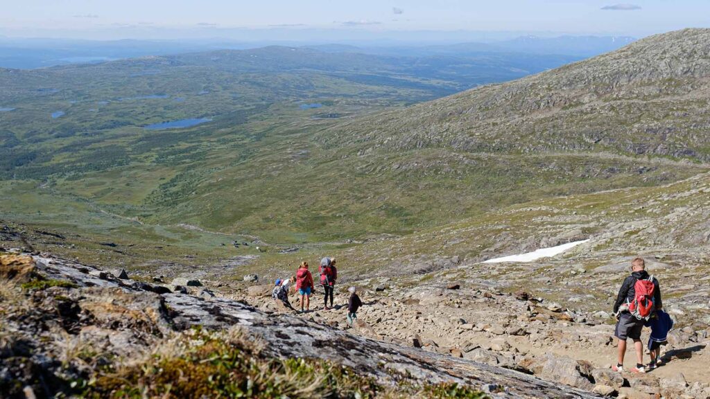
#7 Åreskutan’s top – a goal for all hikers
Climbing Åreskutan’s top 1420 m above sea level is an experience for both young and old. The easiest way up starts at the Gondola and Kabinbanan’s mountain stations and goes along trail 214 on a rock face and wide path. It is 2.1 km long, has an ascent of 187 m and takes about 45 minutes to walk. Choose trail 217 for a steeper but shorter alternative. At the top is Sweden’s highest-located café, Toppstugan, which serves waffles and coffee during the lifts’ opening hours.
#8 Mörvikhummeln – halfway to the top
Halfway up to the top of Åreskutan is one of the most classic and photo-friendly views over Åredalen and Åresjön. To get here there are three different options in different degrees of difficulty; take the lifts all the way up and/or down, hike from Fjällgården via the historic Stjärnvägen or the steeper trail 214b which goes straight up the ski slope.
#9 Fröå mine – family-friendly hiking tour
Easy hike of about 1 hour along trail 221 from Björnen’s trail center up to the old copper mine. This trail is a “Share the trail” on dirt road, which means that e.g. cyclists, horses, walkers, and prams share the road. On-site there are shorter history walks, a barbecue area, and Bergstugan, which serves lunch and coffee. It is also possible to park the car at the mine and walk around the area.
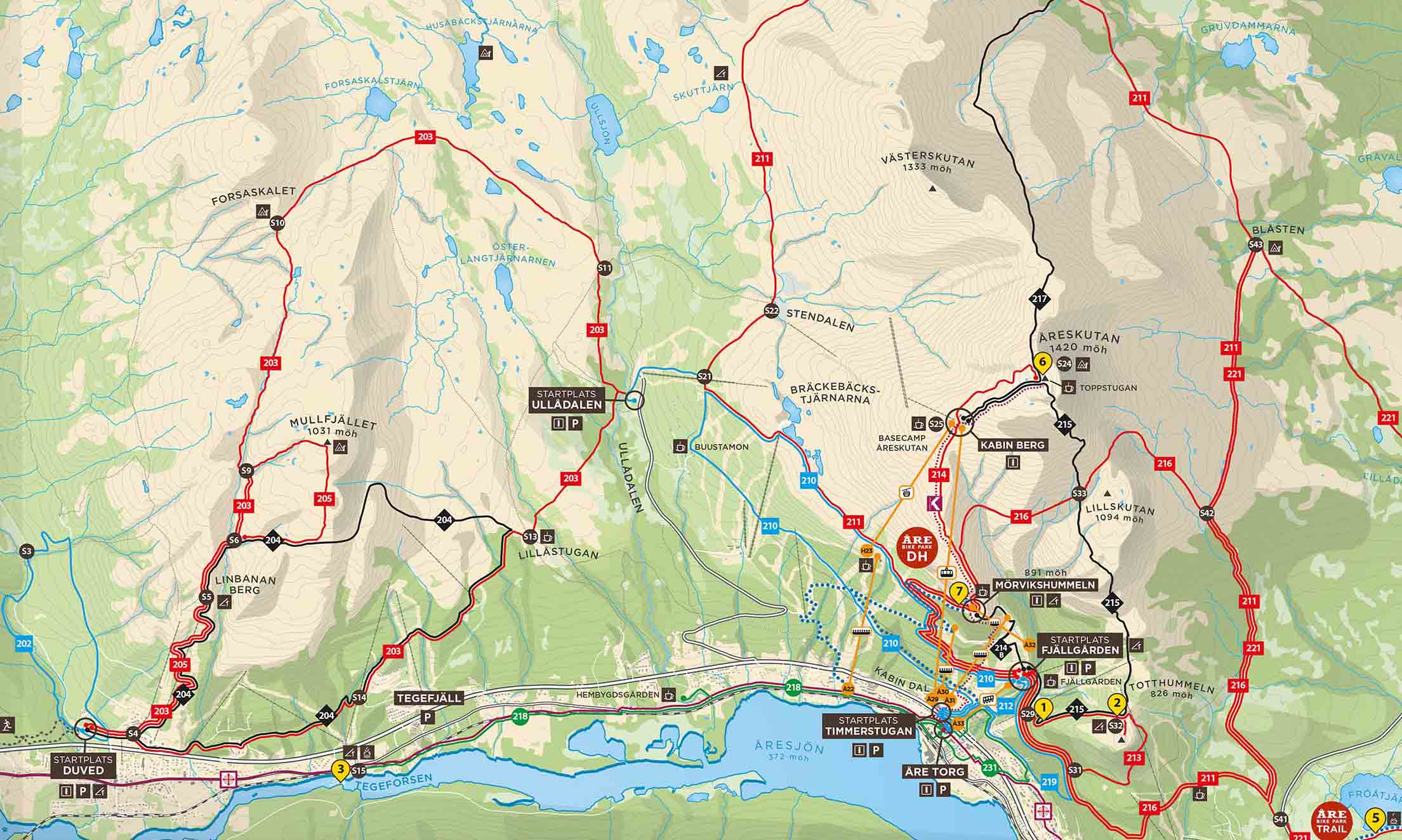
Trail map
Last updated 28 June 2024