
Tough Trail Running Trails in Åre
Foto: Niclas Vestefjell
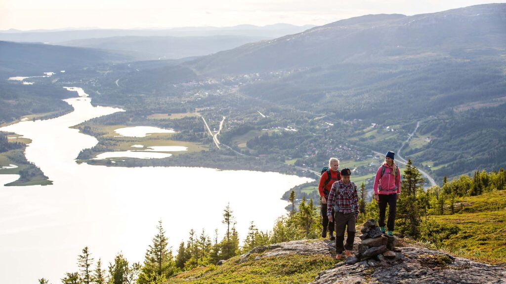
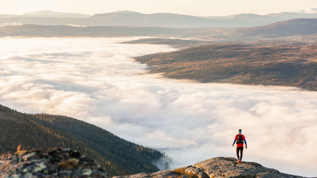
Going uphill is tougher but always better. It’s a workout for your entire body, as well as your mind, and there’s plenty of tough trail running trails that will challenge you in Åre. Find some of our favourite trails that will guarantee to make you sweat below.
Please note: The trails are laid with boardwalks on wetlands and other mounds that have a tendency to be wet. These are convenient for runners but also protect the ground from wear and tear. Stick to the boardwalks as best as you can and avoid running on wet trails (for example, after a rainfall). It’s also common to see reindeer on and around the trails. Please keep your distance, avoid disturbance and, if possible, choose a different route. Thank you!
Totthummeln
PEAK 820 masl | ELEVATION 515 m | DISTANCE 3.3 km |
FIND IT One of Mt. Åreskutan’s twin peaks is Totthummeln, a smaller, rounded, peak in the eastern part of Åre village which is covered with pine trees. You can start från Åre Square, where trail 212 (Trollstigen) starts, and connect to trail 213 at Fjällgården. You can also start behind Tott Hotel and connect to trail 212 from there. As you enter the forested area, keep to your left.
When it’s time to run down, there are two options:
- The short and steeper – make the same route in reverse.
- For the further and less steep – as you reach the top, go back down to trail 213 and follow it clockwise back down.
CHARACTERISTICS Plenty of leafy vegetation, pretty views and the trails is well-trodden. This is one of Åre’s Three peaks to climb during your visit.
Vertical K
PEAK 1420 masl | ELEVATION 1000 m | DISTANCE 5 km
FIND IT The Vertical K trail is marked from the Peak Performance General Store at Åre square, all the way to Mt. Åreskutan’s peak.
When it’s time to descend, there are three options.
- The shortest – 8.1 kilometres via trail 214. Follow the Vertical K trail a short distance (while giving way to those heading up) and follow the gravel road.
- The longer and less used – 9.1 kilometres via trail 215.
- The easiest – take the cable car down.
CHARACTERISTICS The trails is steep and the surface varies from clay to stone and gravel. There are fixed ropes for support at the rougher parts of the trail.
Mullfjället
PEAK 1031 masl | ELEVATION 660 m | DISTANCE 7.5 km
FIND IT Start at Hamreliften in Duved. Follow trail 205 via Hamrebacken and make for the peak. There’s a wind shelter at the peak which may provide a welcome chance to stop and look at the view.
When it’s time to head back, you have three options.
- The short way – take the same route in reverse, back to Hamreliften.
- A bit longer – connect to trail 204 via Tegefjäll.
- The much longer way – connect to trail 203 (Mullfjället), which continues further back/north on Mullfjället, via Ullådalen and Lillåstugan.
CHARACTERISTICS The trail is a mix of gravel road and varying mountainous trail characteristics. This is one of Åre’s Three peaks to climb during your visit.
Please note
The weather conditions may change in a heartbeat so make sure you’re equipped with extra layers of clothing and energy bars or similar and something that ensures you can stay hydrated. And! There’s no shame in turning back. The mountain will be there for another day and better safe than sorry, as they say.
Last updated 16 June 2025


